Lidar, which stands for “Light Detection and Ranging”, is a remote sensing method that uses light in the form of a pulsed laser to measure ranges to the Earth.
Lidar resolves bedrock structures and is used to refine the locations of significant shear zones, and more generally toward characterizing the structural architecture of the gold camp.
BHP Minerals Canada conducted exploration work in the early 1990’s, returning a series of 34 channel samples that were cut normal to the vein at approximately two meter intervals along the length of the vein exposed in the trenches.
Historical assay results contained in this press release were not verified by the Company, however, the historical reports referenced were authored by experienced geoscientists and copies of laboratory assay sheets were commonly inserted in the reports.
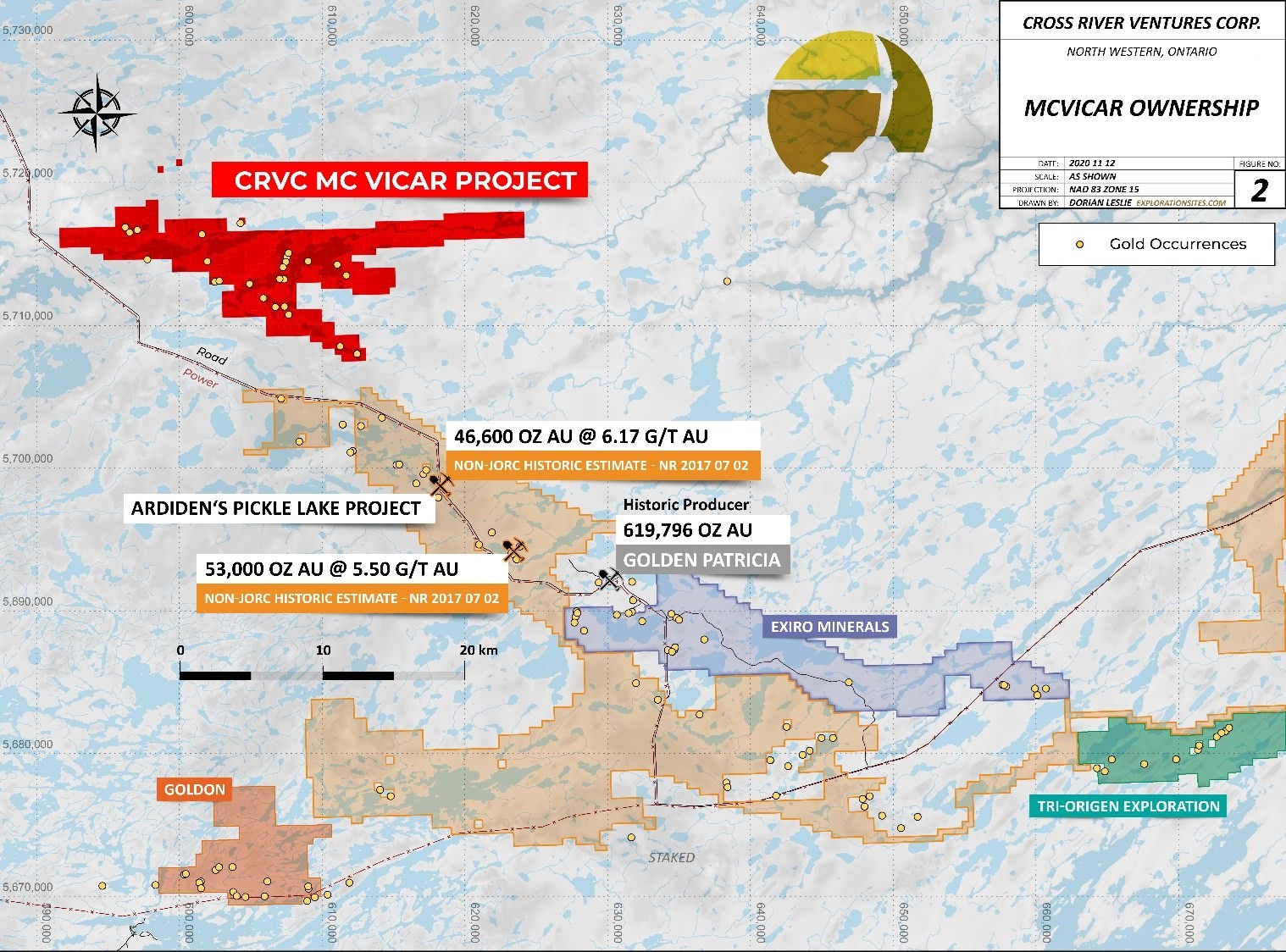
The Company controls a multiple project portfolio in NW Ontario, Canada, with highly prospective ground in and among prolific, gold bearing greenstone belts.
Actual results could differ materially because of factors discussed in the management discussion and analysis section of our interim and most recent annual financial statement or other reports and filings with the Canadian Securities Exchange and applicable Canadian securities regulations.
* Golden Patricia Mine – Harron, G.A.2009, Technical Report on Three Gold Exploration Properties Pickle Lake Area, Ontario, Canada.