– Plenty of clouds continue rotating across the area associated with an area of low pressure moving north and east from The Great Lakes this morning.
The clearing trend will continue through the evening and as winds diminish lows may drop to around 35 in areas to the north by sunrise which may again lead to the potential for patchy frost.
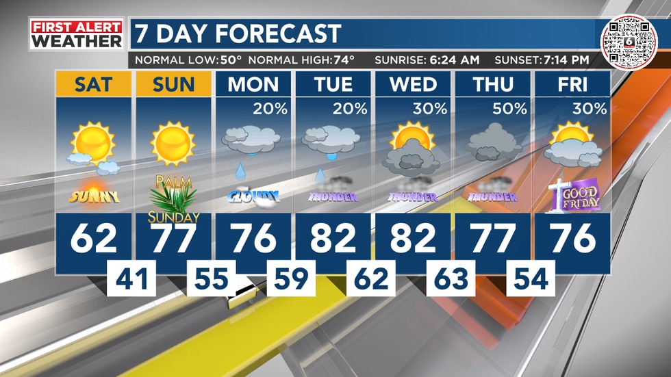
An area of low pressure to the west will grow stronger by Tuesday and disturbances spinning around the low may bring another round of rain and thunderstorms with the better chances coming in West and Northwest Alabama.