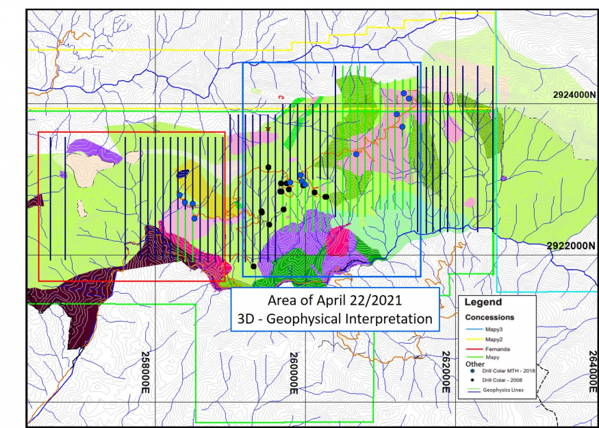
This 3D modelling shows strong correlation between anomalous surface gold-in-soil, chip and channel samples together with numerous gold intervals in diamond drilling and extends these coincident features over what now totals a 2.4 km trend of a larger 6 km trend of surface gold-silver mineralization at Tenoriba.
Thomas Atkins, President and CEO of Mammoth commented on results from the geophysical modelling, stating: “Mammoth having completed the infill geophysical survey in early April, we continue to work with the Intelligent Exploration geophysicists to compile and model in three dimensions the results from the survey together with other surface and drill data.
“We’re very pleased with what we’re seeing so far in this modelling.
As part of its first quarter 2021 surface exploration program Mammoth is advancing detailed confirmation geological mapping and expanded sampling with an infill IP/Mag geophysical survey and 3D drill target modelling.
Mammoth is working closely with Intelligent Exploration geophysicists to model the IP/Mag geophysical characteristics of the rocks in this area employing 3D technology combining a combination of surface and drill data to assist in identifying attractive targets for the continuation of the surface gold-silver mineralization at depth.
Mammoth Resources in the 5,333 hectare Tenoriba gold property located in the Sierra Madre Precious Metal Belt in southwestern Chihuahua State, Mexico.
Any forward-looking statement speaks only as of the date on which it is made and, except as may be required by applicable securities laws, the Company disclaims any intent or obligation to update any forward-looking statement, whether as a result of new information, future events or results or otherwise.